Skip to content

How a description becomes a shapefile.

Five stages take a legal description from source text to reviewed, exportable geometry.

  1. Stage 1

    Parse

    The description becomes structured calls.

    TractEdge reads the description and transcribes it into bearings, distances, adjoiners and natural features. Every value has to ground against the exact span of the deed it came from, or its confidence goes to zero. Text that never became a call stays marked in the source pane.
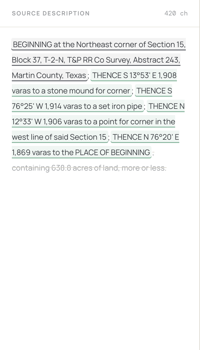
    Deed text in the source pane with every grounded phrase underlined and colour-coded by confidence.
  2. Stage 2

    Anchor

    The calls get placed on the Earth.

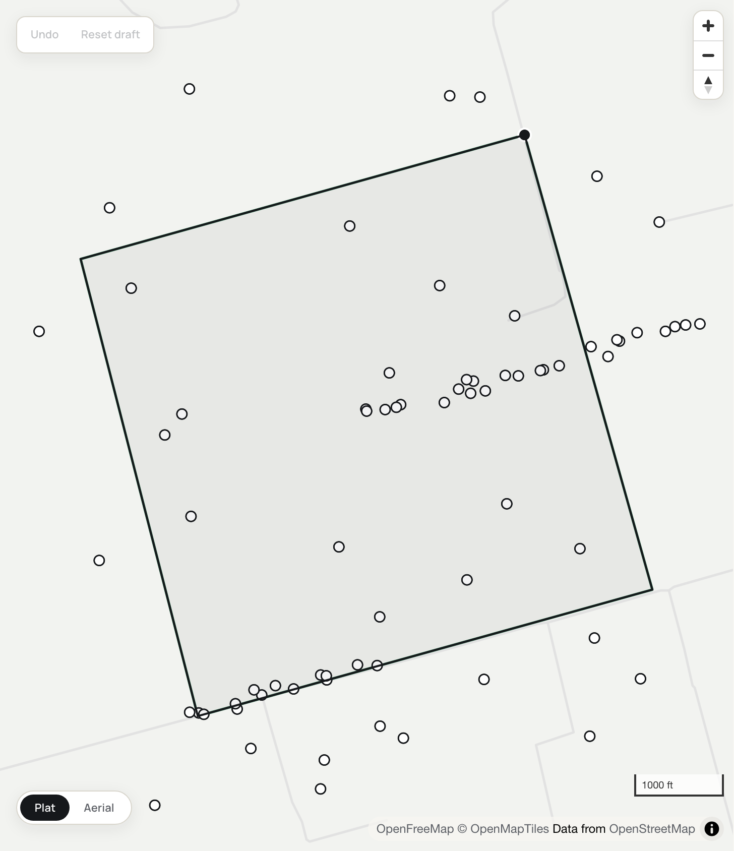
    TractEdge resolves the survey reference against RRC original-land-survey geometry and uses the matched reference to place the point of beginning. Adjoiner calls follow the matched reference line, and the state-reported wells in and around the tract are pulled in automatically. Anchoring decisions include confidence values, and the public reference geometry is a digital interpretation, not a legal survey.

    A drafted Martin County tract placed against survey geometry, point of beginning marked, with RRC-reported wells dotted in and around the boundary.
  3. Stage 3

    Traverse

    A deterministic engine does all the geometry.

    The engine computes bearings, distances, closure and an optional Bowditch adjustment in ordinary code. Once the calls and anchor are fixed, the resulting geometry is repeatable.
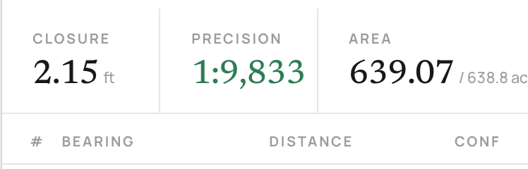
    The closure readout: misclosure 2.15 ft, precision 1:9,833, computed area 639.07 acres against 638.8 declared.
  4. Stage 4

    Edit

    You are the final authority.

    The editor puts the deed text, the calls table and the map side by side. Selection links them: click a call and its phrase highlights; click the phrase and the leg highlights on the map. Vertices are draggable and closure recomputes live. Where the point of beginning couldn't be resolved with confidence, you place it yourself.
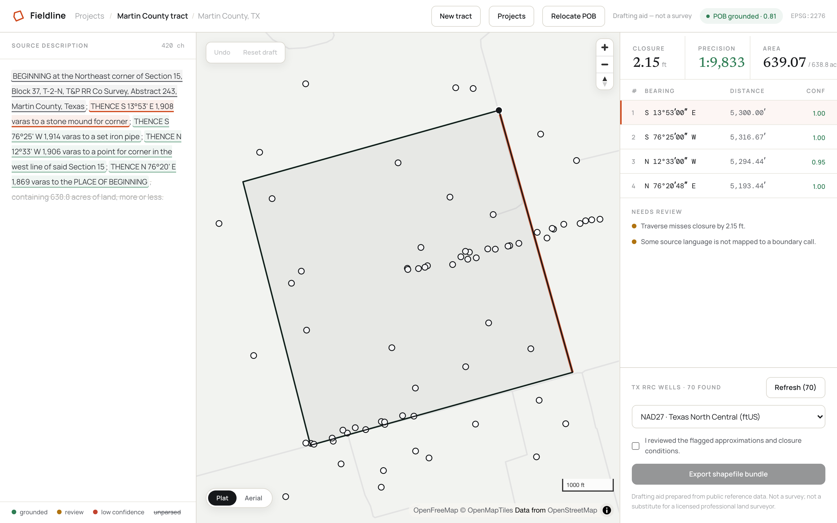
    The full editor: deed text, map and calls table side by side, a selected call highlighted in all three panes, and seventy RRC wells on the map.
  5. Stage 5

    Export

    A bundle your GIS takes as-is.

    Boundary, vertices and wells as shapefiles, with GeoJSON, KML and a README, in the Texas State Plane datum you ask for: NAD27 or NAD83, ftUS. NAD27 exports use grid-based NADCON5 transforms. TractEdge does not export NAD27 when the required grid is unavailable.
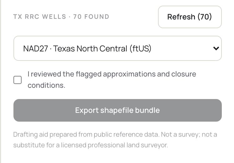
    The export controls: Texas State Plane datum selection, the review confirmation, and the export button.
Against what you already use

How TractEdge fits with existing tools.

ToolWhat it doesWhat TractEdge adds
Enverus, TGSWells, units and leases that are already mapped, with the analytics on top.Drafts and anchors a new legal description that is not already mapped.
Net Deed Plotter, Metes & BoundsYou type the calls, it draws the shape, and it does that well.Reads the description and places the resulting tract against public survey geometry.
A contract landman and QGISThe whole job, correctly, with a professional's judgement attached.Provides a faster first-pass draft for evaluation and review.
A chatbot and someone who knows GISTurns calls into coordinates quickly.Grounded extraction, survey anchoring, closure reporting and datum-aware export.
TractEdgeReads the description, anchors it to live public survey geometry, runs a deterministic traverse, reports closure, and exports in the datum you work in.
Coverage and scope

What TractEdge supports.

Coverage depends on the available public reference geometry.

Metes-and-bounds coverage

Anchoring resolves against Texas RRC original land survey geometry. This is TractEdge's strongest coverage.

Section and aliquot coverage

New Mexico section, township-range and aliquot descriptions use BLM CadNSDI reference geometry. Oklahoma is not currently supported.

Manual point of beginning

If the survey reference or point of beginning cannot be resolved from public geometry, you can place the point manually.

Repeatability and professional scope

The reading step can vary between runs. Once the calls and anchor are fixed, the geometry is repeatable. TractEdge is a drafting aid and does not determine a legal boundary.

Try one of your descriptions.

Paste a legal description to review an editable draft against the source text. Two free drafts, no card.